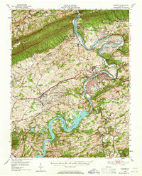
1950 Map of Radford
USGS Topo · Published 1965About this map
Claytor Lake dominates the southern landscape of this mid-century survey, its fingers reaching into the surrounding terrain behind the Claytor Dam. To the north, the Radford Arsenal US Military Reservation occupies a massive bend in the New River, illustrating the industrial and military footprint in Pulaski and Montgomery counties. This era shows a well-established transportation network where the Norfolk and Western railway and the Lee Highway intersect near the town of Dublin. Genealogists and local historians can locate smaller communities and landmarks such as Newbern, McAdam, and the County Farm. Numerous rural institutions are documented, including Cecils Chapel Sch and Back Creek Chapel, alongside the high ridges of Walker Mountain and Cloyds Mountain.
Find a feature on this map
91 named features on this map. Tap any name to fly to it.
Don’t see what you’re looking for? This feature index may not catch every label — zoom into the map to look around manually.
Map Details
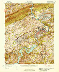
Editions of this 1950 Radford Map
3 editions found

Other maps of this area

1889 · Hillsville
USGS Topo · 1:125,000

1890 · Dublin
USGS Topo · 1:125,000

1890 · Christiansburg
USGS Topo · 1:125,000

1891 · Dublin
USGS Topo · 1:125,000

1892 · Hillsville
USGS Topo · 1:125,000

1896 · Hillsville
USGS Topo · 1:125,000

1913 · Peterstown
USGS Topo · 1:48,000

1916 · Peterstown
USGS Topo · 1:62,500

1923 · Pearisburg
USGS Topo · 1:62,500

1923 · Waiteville
USGS Topo · 1:62,500