
1961 Map of Radium
USGS Topo · Published 1963About this map
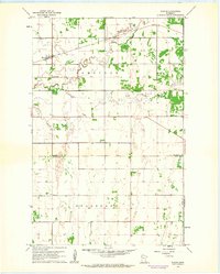
The Soo Line railroad cuts a straight diagonal across the northwestern corner of this territory, where the small settlement of Radium serves as a local focal point for the surrounding prairie. This area, largely defined by the townships of Comstock and Helgeland, sits at the intersection of Marshall and Polk counties. The land is drained by the winding course of the Snake River and its South Branch Snake River, which meander through a landscape marked by sectional farming and occasional landmarks of community life. Near the river's bend, the Immanuel Ch and Immanuel Cem provide significant genealogical touchstones for the region's early residents, while a solitary Townhall in the southern portion of the map indicates the center of local civic administration.
Find a feature on this map
12 named features on this map. Tap any name to fly to it.
Don’t see what you’re looking for? This feature index may not catch every label — zoom into the map to look around manually.
Map Details
Editions of this 1961 Radium Map
2 editions found
Other maps of this area

1918 · Angus
USGS Topo · 1:62,500

1918 · Viking
USGS Topo · 1:62,500

1952 · Thief River Falls
USGS Topo · 1:250,000

1956 · Thief River Falls
USGS Topo · 1:250,000

1956 · Florian
USGS Topo · 1:62,500

1957 · Thief River Falls
USGS Topo · 1:250,000

1957 · Newfolden
USGS Topo · 1:62,500

1959 · Viking
USGS Topo · 1:24,000
1959 · Viking SW
USGS Topo · 1:24,000
1961 · Angus SE
USGS Topo · 1:24,000