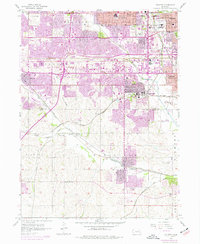
1956 Map of Ralston
USGS Topo · Published 1977About this map
The Union Pacific and Burlington Northern corridors define the industrial and suburban expansion south of Omaha in the mid-1950s. This survey records the rapid growth of Papillion, Ralston, and Millard, with purple revisions from 1969 and 1975 showing the emergence of La Vista. The landscape is a mix of traditional rural infrastructure, like the Prairie Queen Sch and Portal Sch, and modern urban additions such as the Millard Municipal Airport and Bergan Hosp.
Find a feature on this map
55 named features on this map. Tap any name to fly to it.
Don’t see what you’re looking for? This feature index may not catch every label — zoom into the map to look around manually.
Map Details
Editions of this 1956 Ralston Map
5 editions found
Other maps of this area

1893 · Omaha
USGS Topo · 1:62,500

1893 · Fremont
USGS Topo · 1:125,000

1896 · Fremont
USGS Topo · 1:125,000

1954 · Omaha
USGS Topo · 1:250,000

1955 · Fremont
USGS Topo · 1:250,000

1956 · Gretna
USGS Topo · 1:24,000

1956 · Cedar Creek
USGS Topo · 1:24,000

1956 · Ralston
USGS Topo · 1:24,000

1956 · Springfield
USGS Topo · 1:24,000

1956 · Irvington
USGS Topo · 1:24,000