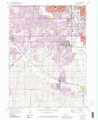
1956 Map of Ralston
USGS Topo · Published 1984About this map
Boys Town and the expanding suburbs of Omaha define the landscape of this mid-century survey, which documents the rapid post-war growth across the Douglas Co and Sarpy Co line. The map captures a moment when smaller communities like Millard, Ralston, and Papillion remained distinct, though the purple photorevisions of 1984 trace the encroaching suburban sprawl and road network expansion. Transport and commerce are anchored by the Union Pacific and Burlington Northern railroads, which weave through a geography carved by the various branches of Papillion Creek.
Find a feature on this map
39 named features on this map. Tap any name to fly to it.
Don’t see what you’re looking for? This feature index may not catch every label — zoom into the map to look around manually.
Map Details
Editions of this 1956 Ralston Map
5 editions found
Other maps of this area

1893 · Omaha
USGS Topo · 1:62,500

1893 · Fremont
USGS Topo · 1:125,000

1896 · Fremont
USGS Topo · 1:125,000

1954 · Omaha
USGS Topo · 1:250,000

1955 · Fremont
USGS Topo · 1:250,000

1956 · Gretna
USGS Topo · 1:24,000

1956 · Cedar Creek
USGS Topo · 1:24,000

1956 · Ralston
USGS Topo · 1:24,000

1956 · Springfield
USGS Topo · 1:24,000

1956 · Irvington
USGS Topo · 1:24,000