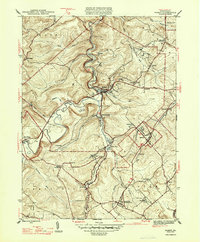
1947 Map of Ramey
USGS Topo · Published 1947About this map
Clearfield Creek winds through the heart of this central Pennsylvania landscape, serving as a geographic anchor for numerous small mining and rail settlements. In the late 1940s, the region was defined by a complex network of railroads, including the Pennsylvania and New York Central, which serviced coal-rich areas like Madera and Ramey. These tracks follow the narrow valley floors, connecting industrial hubs to smaller outposts such as Belsena and Banian Junction.
Find a feature on this map
46 named features on this map. Tap any name to fly to it.
Don’t see what you’re looking for? This feature index may not catch every label — zoom into the map to look around manually.
Map Details
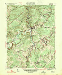
Editions of this 1947 Ramey Map
2 editions found
Other maps of this area

1902 · Patton
USGS Topo · 1:62,500

1903 · Curwensville
USGS Topo · 1:62,500

1903 · Houtzdale
USGS Topo · 1:62,500

1904 · Patton
USGS Topo · 1:62,500

1905 · Houtzdale
USGS Topo · 1:62,500

1920 · Altoona
USGS Topo · 1:62,500

1922 · Altoona
USGS Topo · 1:62,500

1939 · Curwensville
USGS Topo · 1:62,500

1942 · Curwensville
USGS Topo · 1:62,500

1943 · Punxsutawney
USGS Topo · 1:125,000