
1958 Map of Ranch Canyon
USGS Topo · Published 1960About this map
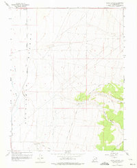
Escalante Desert terrain and the irrigation infrastructure of the late 1950s define this survey of Beaver County. The map captures the meeting point between the arid desert floor and the drainage systems of Ranch Canyon and Corral Canyon to the east. Agricultural development is evident through the engineered paths of The Low Line Canal and the High Line Canal, which parallel the Beaver River to manage water resources in this parched environment.
Find a feature on this map
16 named features on this map. Tap any name to fly to it.
Don’t see what you’re looking for? This feature index may not catch every label — zoom into the map to look around manually.
Map Details
Editions of this 1958 Ranch Canyon Map
3 editions found
Other maps of this area

1885 · Beaver
USGS Topo · 1:250,000

1953 · Milford Flat
USGS Topo · 1:24,000

1953 · Cave Canyon
USGS Topo · 1:24,000

1953 · Richfield
USGS Topo · 1:250,000

1958 · Richfield
USGS Topo · 1:250,000

1958 · Milford
USGS Topo · 1:62,500

1958 · Milford
USGS Topo · 1:24,000

1958 · Adamsville
USGS Topo · 1:62,500

1960 · Beaver Lake Mts.
USGS Topo · 1:62,500

1973 · Pinnacle Pass
USGS Topo · 1:24,000