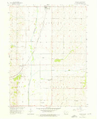
1957 Map of Randolph
USGS Topo · Published 1976About this map
The West Nishnabotna River meanders through this agricultural section of Fremont County, protected by a system of levees that delineate the floodplain from the surrounding uplands. The settlement of Randolph sits in the northern reaches, while Anderson serves as a secondary point of habitation to the southwest. This mid-century landscape is defined by its transition away from traditional rural infrastructure, evidenced by the numerous decommissioned educational sites scattered across the townships, including Mayflower Sch, Riverside Sch, and Center Sch.
Find a feature on this map
18 named features on this map. Tap any name to fly to it.
Don’t see what you’re looking for? This feature index may not catch every label — zoom into the map to look around manually.
Map Details
Editions of this 1957 Randolph Map
2 editions found
Other maps of this area

1939 · Farragut
USGS Topo · 1:62,500

1939 · Hamburg
USGS Topo · 1:62,500

1940 · Farragut
USGS Topo · 1:62,500

1941 · Hamburg
USGS Topo · 1:62,500

1955 · Nebraska City
USGS Topo · 1:250,000

1957 · Nebraska City
USGS Topo · 1:250,000

1957 · Randolph
USGS Topo · 1:24,000

1957 · Tabor
USGS Topo · 1:24,000

1957 · Tabor NE
USGS Topo · 1:24,000

1957 · Tabor SW
USGS Topo · 1:24,000