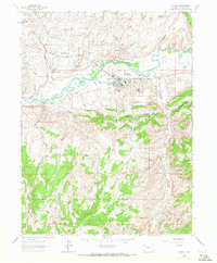
1962 Map of Rangely
USGS Topo · Published 1972About this map
The Rangely Oil Field dominates this 1960s landscape, illustrating the industrial footprint of energy extraction along the White River. The town of Rangely serves as the central hub, featuring critical infrastructure such as a Power Plant, Hospital, and Rangely College. Surrounding the town, numerous worker encampments like California Camp, Texas Camp, Sharples Camp, and Warren Camp are scattered across the Basin, marking the housing patterns of the era's oil workers.
Find a feature on this map
38 named features on this map. Tap any name to fly to it.
Don’t see what you’re looking for? This feature index may not catch every label — zoom into the map to look around manually.
Map Details
Editions of this 1962 Rangely Map
4 editions found
Other maps of this area

1907 · Rangely
USGS Topo · 1:125,000

1910 · Rangely
USGS Topo · 1:125,000

1954 · Vernal
USGS Topo · 1:250,000

1956 · Grand Junction
USGS Topo · 1:250,000

1958 · Vernal
USGS Topo · 1:250,000

1959 · Grand Junction
USGS Topo · 1:250,000

1960 · Vernal
USGS Topo · 1:250,000

1960 · Grand Junction
USGS Topo · 1:250,000

1962 · Grand Junction
USGS Topo · 1:250,000

1962 · Rangely NE
USGS Topo · 1:24,000