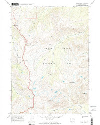
1968 Map of Ranger Peak
USGS Topo · Published 1973About this map
Grand Teton National Park and Targhee National Forest meet along a sharp high-altitude divide in this late 1960s survey. The landscape is defined by massive peaks and glacial drainage patterns, including the prominent Ranger Peak and Doane Peak. The presence of a Patrol Cabin near Webb Canyon highlights the area's management as a protected wilderness, accessible only by a network of pack trails such as the Camp Lake Trail and Bitch Creek Trail.
Find a feature on this map
36 named features on this map. Tap any name to fly to it.
Don’t see what you’re looking for? This feature index may not catch every label — zoom into the map to look around manually.
Map Details
Editions of this 1968 Ranger Peak Map
3 editions found
Other maps of this area

1886 · Shoshone
USGS Topo · 1:125,000

1888 · Shoshone
USGS Topo · 1:125,000

1895 · Shoshone
USGS Topo · 1:125,000

1899 · Grand Teton
USGS Topo · 1:125,000

1901 · Shoshone
USGS Topo · 1:125,000

1901 · Grand Teton
USGS Topo · 1:125,000

1908 · Shoshone
USGS Topo · 1:125,000

1911 · Shoshone
USGS Topo · 1:125,000

1955 · Ashton
USGS Topo · 1:250,000

1955 · Driggs
USGS Topo · 1:250,000