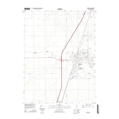
2015 Map of Rantoul
USGS Topo · Published 2015About this map
The Rantoul municipal landscape is anchored by the sprawling Rantoul National Aviation Center Airport-Frank Elliott Field, reflecting the area's deep ties to aviation and mid-century military infrastructure. This 2015 layout details the transition from the old base airfield to a modern civic center, surrounded by residential developments such as Alta Brown and Eastview Dr. Outside the town center, the landscape reverts to the characteristic flat agricultural plains of Champaign County, drained by the meandering Wildcat Slough and the straightened channels of the Big Ditch. Small, dispersed settlements like Tomlinson and Prospect remain connected by an extensive grid of country roads, while several cemeteries, including Maplewood Cem and Eden Cem, mark the historical boundaries of local communities. The primary north-south corridor through Thomasboro and northward through the heart of the region illustrates the enduring importance of this central Illinois transport spine.
Find a feature on this map
69 named features on this map. Tap any name to fly to it.
Don’t see what you’re looking for? This feature index may not catch every label — zoom into the map to look around manually.
Map Details
Editions of this 2015 Rantoul Map
This is the sole edition of this map. No revisions or reprints were ever made.
Other maps of this area

1906 · Urbana
USGS Topo · 1:62,500

1907 · Mahomet
USGS Topo · 1:62,500

1924 · Paxton
USGS Topo · 1:62,500

1927 · Paxton
USGS Topo · 1:62,500

1928 · Gibson City
USGS Topo · 1:62,500

1949 · Paxton
USGS Topo · 1:62,500

1957 · Urbana
USGS Topo · 1:62,500

1957 · Paxton
USGS Topo · 1:62,500

1957 · Gibson City
USGS Topo · 1:62,500

1957 · Rising
USGS Topo · 1:24,000