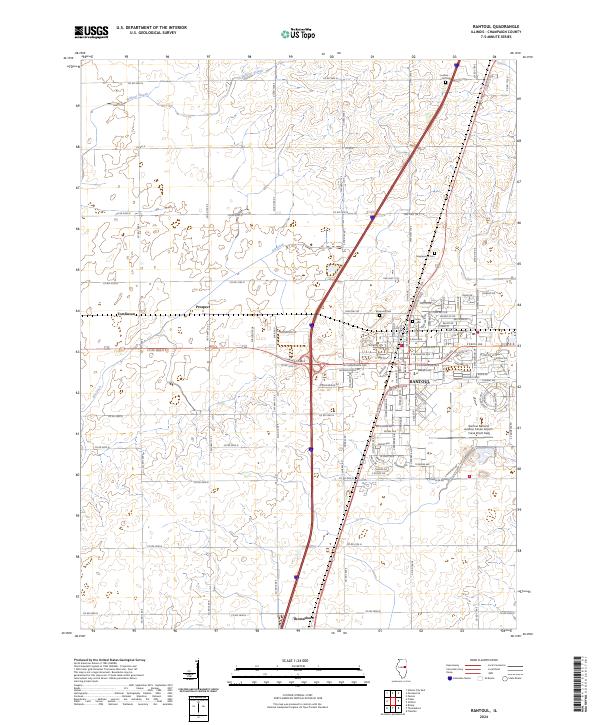
2024 Map of Rantoul
USGS Topo · Published 2024About this map
Rantoul serves as the central hub of this Champaign County landscape, showing the dense residential and industrial grid that characterizes its modern layout. The footprint of the Rantoul National Aviation Center Airport-Frank Elliott Field dominates the southeastern quadrant, a clear indicator of the area's long-standing connection to aviation. Outside the primary settlement, the terrain transitions into a organized grid of agricultural land and drainage systems such as Wildcat Slough and the Big Ditch. Smaller historically significant points of interest like Tomlinson and Prospect appear along the township roads, while local genealogy is supported by the locations of several burial grounds, including Ludlow Cem to the north and the cluster of Elmwood Cem and Eden Cem near the town center. The map also identifies local institutions such as the Eater school, reflecting the community infrastructure of the early 21st century.
Find a feature on this map
102 named features on this map. Tap any name to fly to it.
Don’t see what you’re looking for? This feature index may not catch every label — zoom into the map to look around manually.
Map Details
Editions of this 2024 Rantoul Map
This is the sole edition of this map. No revisions or reprints were ever made.
Other maps of this area

1906 · Urbana
USGS Topo · 1:62,500

1907 · Mahomet
USGS Topo · 1:62,500

1924 · Paxton
USGS Topo · 1:62,500

1927 · Paxton
USGS Topo · 1:62,500

1928 · Gibson City
USGS Topo · 1:62,500

1949 · Paxton
USGS Topo · 1:62,500

1957 · Urbana
USGS Topo · 1:62,500

1957 · Paxton
USGS Topo · 1:62,500

1957 · Gibson City
USGS Topo · 1:62,500

1957 · Rising
USGS Topo · 1:24,000