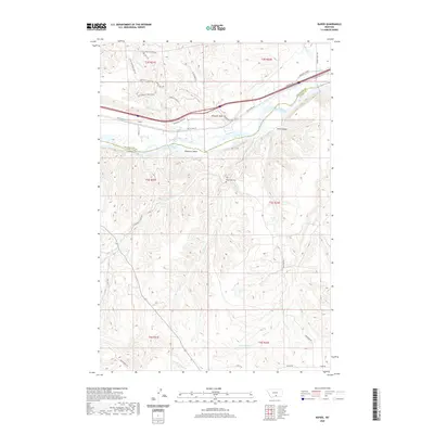
2020 Map of Rapids
USGS Topo · Published 2020About this map
The Yellowstone River cuts through the northern portion of this landscape, separating the high elevations of Bobcat Plateau from the intricate coulees and ridges to the south. Near the river, the small settlement of Rapids is situated along the historic path of Old US Hwy 10, while Westover Island and the turbulent Trout Rapids define the waterway's character. The map provides a detailed view of the regional topography, including named landmarks like Wimsett Point and the deep cut of Wolf Canyon.
Find a feature on this map
44 named features on this map. Tap any name to fly to it.
Don’t see what you’re looking for? This feature index may not catch every label — zoom into the map to look around manually.
Map Details
Editions of this 2020 Rapids Map
This is the sole edition of this map. No revisions or reprints were ever made.
Other maps of this area

1892 · Stillwater
USGS Topo · 1:125,000

1932 · Red Lodge No 1
USGS Topo · 1:48,000

1954 · Billings
USGS Topo · 1:250,000

1956 · Shane Ridge
USGS Topo · 1:24,000

1956 · Horse Butte
USGS Topo · 1:24,000

1956 · Columbus East
USGS Topo · 1:24,000

1956 · Fromberg
USGS Topo · 1:24,000

1956 · Rapids
USGS Topo · 1:24,000
1956 · Boyd
USGS Topo · 1:24,000

1956 · Park City
USGS Topo · 1:24,000