
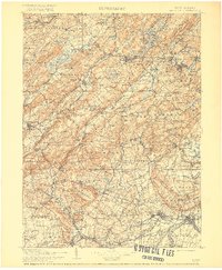
1905 Map of Raritan
USGS Topo · Published 1905About this map
Jenny Jump Mountain and the high ridges of Cushetunk Mountain define the topography of this early 20th-century New Jersey landscape. The map captures a complex industrial and transport network, featuring an extensive system of rail lines such as the Delaware Lackawanna and Western R.R. and the Morris and Essex R.R., which navigated the valleys between Schooley Mountain and Green Pond Mountain.
Find a feature on this map
310 named features on this map. Tap any name to fly to it.
Don’t see what you’re looking for? This feature index may not catch every label — zoom into the map to look around manually.
Map Details
Editions of this 1905 Raritan Map
2 editions found
Other maps of this area

1888 · Franklin
USGS Topo · 1:62,500

1888 · Plainfield
USGS Topo · 1:62,500

1888 · Morristown
USGS Topo · 1:62,500

1888 · Hackettstown
USGS Topo · 1:62,500

1888 · New Brunswick
USGS Topo · 1:62,500

1888 · Princeton
USGS Topo · 1:62,500

1888 · Lake Hopatcong
USGS Topo · 1:62,500

1890 · Easton
USGS Topo · 1:62,500

1890 · High Bridge
USGS Topo · 1:62,500

1890 · Lambertville
USGS Topo · 1:62,500
Featured Places
- Franklin Township, NJ
- Parsippany-Troy Hills, NJ
- Piscataway Township, NJ
- Bridgewater Township, NJ
- Hillsborough Township, NJ