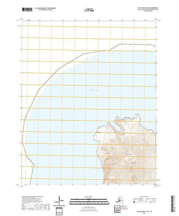
2021 Map of Rat Islands D-6 SW
USGS Topo · Published 2021About this map
Segula Island rises sharply from the Bering Sea in this 2021 topographic survey of the Aleutian chain. The island is dominated by the volcanic massif of Segula Peak, where steep contour intervals reveal the dramatic elevation changes of the summit. The coastline is defined by prominent maritime landmarks including Gula Point to the north, Zapad Head on the western shore, and Chugul Point to the south. To the west, the waters of Segula Pass separate this landmass from neighboring islands. This map provides a detailed view of the island’s natural topography without any recorded human settlements or infrastructure, highlighting the isolation and untouched character of the western Aleutians West Census Area.
Find a feature on this map
8 named features on this map. Tap any name to fly to it.
Don’t see what you’re looking for? This feature index may not catch every label — zoom into the map to look around manually.
Map Details
Editions of this 2021 Rat Islands D-6 SW Map
This is the sole edition of this map. No revisions or reprints were ever made.