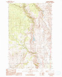
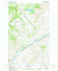
1989 Map of Rat Lake
USGS Topo · Published 1993About this map
Rat Lake lies at the center of this Okanogan County landscape, part of a drainage system that includes Rowel Creek and Swamp Creek. The terrain is defined by dramatic elevation changes, rising toward Dent Mtn and Bald Knob, while deep cuts like Whitestone Canyon and Davis Canyon carve through the upland. This 1980s-era survey reveals a sparsely populated region primarily utilized for conservation and utility, evidenced by the expansive Indian Dan State Wildlife Recreation Area and a Radio Facility located near the ridge. Small indicators of local history appear in the form of a lone Cem and scattered Corral sites, suggesting a legacy of ranching and early settlement amidst the Harmony Heights ridgelines. Water remains the primary focal point, from the small Starzman Lake to various springs and wells that support this arid interior environment.
Find a feature on this map
21 named features on this map. Tap any name to fly to it.
Don’t see what you’re looking for? This feature index may not catch every label — zoom into the map to look around manually.
Map Details
Editions of this 1989 Rat Lake Map
2 editions found
Other maps of this area

1905 · Okanogan
USGS Topo · 1:125,000

1954 · Okanogan
USGS Topo · 1:250,000

1956 · Loup Loup
USGS Topo · 1:62,500

1957 · Okanogan
USGS Topo · 1:62,500

1957 · Bridgeport
USGS Topo · 1:62,500

1957 · Brewster
USGS Topo · 1:62,500

1958 · Okanogan
USGS Topo · 1:250,000
1980 · Bridgeport
USGS Topo · 1:24,000
1980 · Monse
USGS Topo · 1:24,000
1981 · Malott
USGS Topo · 1:24,000