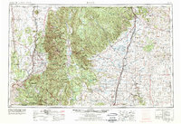
1954 Map of Raton
USGS Topo · Published 1977About this map
The Sangre de Cristo Mountains dominate this mid-century landscape, housing the state's highest point at Wheeler Peak. This survey documents the transition from the high-altitude Carson National Forest to the plains of the Canadian River basin. Tribal lands including the Taos Pueblo Indian Reservation and Picuris Pueblo are clearly delineated alongside the historic Philmont Scout Ranch Headquarters. The transport network reveals the enduring path of the Atchison Topeka and Santa Fe railroad, which parallels the path of the Vermejo River through Raton. A notable remnant of earlier infrastructure is the Lava railroad grade in the northeast, while water management for ranching and conservation is evident at Springer Lake and the Maxwell NWR. Settlement patterns concentrate in fertile valleys near Questa and Springer, reflecting a geography shaped by mountain runoff and rail access.
Find a feature on this map
113 named features on this map. Tap any name to fly to it.
Don’t see what you’re looking for? This feature index may not catch every label — zoom into the map to look around manually.
Map Details
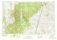
Editions of this 1954 Raton Map
3 editions found

Other maps of this area

1889 · Las Vegas
USGS Topo · 1:125,000

1889 · Santa Fe
USGS Topo · 1:125,000

1891 · Las Vegas
USGS Topo · 1:125,000

1891 · Spanish Peaks
USGS Topo · 1:125,000

1891 · Mesa De Maya
USGS Topo · 1:125,000

1892 · Santa Clara
USGS Topo · 1:125,000

1892 · Watrous
USGS Topo · 1:125,000

1892 · Elmoro
USGS Topo · 1:125,000

1893 · Spanish Peaks
USGS Topo · 1:125,000

1893 · Las Vegas
USGS Topo · 1:125,000