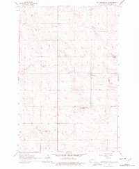
1963 Map of Rattlesnake Butte
USGS Topo · Published 1978About this map
Rattlesnake Butte rises above the drainage network of Billings County in this early 1960s survey, marking a landscape defined by the winding course of the Green River and its South Fork. The map reveals a dispersed rural community infrastructure anchored by parochial and educational landmarks, including St Demetrius Church and nearby St Marys Cemetery, as well as St Boniface Cemetery.
Find a feature on this map
16 named features on this map. Tap any name to fly to it.
Don’t see what you’re looking for? This feature index may not catch every label — zoom into the map to look around manually.
Map Details
Editions of this 1963 Rattlesnake Butte Map
2 editions found

Other maps of this area

1953 · Dickinson
USGS Topo · 1:250,000

1953 · Watford City
USGS Topo · 1:250,000

1957 · Dickinson
USGS Topo · 1:250,000

1957 · Watford City
USGS Topo · 1:250,000

1962 · Fryburg NE
USGS Topo · 1:24,000

1962 · Belfield NE
USGS Topo · 1:24,000

1962 · Belfield
USGS Topo · 1:24,000

1963 · Fairfield SE
USGS Topo · 1:24,000

1963 · Fairfield
USGS Topo · 1:24,000

1963 · Gorham SE
USGS Topo · 1:24,000