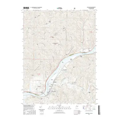
2016 Map of Raven Rock
USGS Topo · Published 2016About this map
The Ohio River serves as the central artery and state boundary in this 2016 survey, where West Virginia's St. Marys and Ohio's Newport face each other across the water. The landscape is defined by the significant islands of the river, specifically Grape Island and the elongated Middle Island, which features the Middle Island Creek Bridge. On the West Virginia side, the city of St. Marys shows a dense street grid including Riverside Dr and an industrial Oil Refinery sector near Pickens Bottom.
Find a feature on this map
113 named features on this map. Tap any name to fly to it.
Don’t see what you’re looking for? This feature index may not catch every label — zoom into the map to look around manually.
Map Details
Editions of this 2016 Raven Rock Map
This is the sole edition of this map. No revisions or reprints were ever made.
Other maps of this area

1903 · Macksburg
USGS Topo · 1:62,500

1904 · Marietta
USGS Topo · 1:62,500

1905 · New Matamoras
USGS Topo · 1:62,500

1905 · Macksburg
USGS Topo · 1:62,500

1906 · Saint Marys
USGS Topo · 1:62,500

1924 · St Marys
USGS Topo · 1:62,500

1924 · New Matamoras
USGS Topo · 1:62,500

1924 · Marietta
USGS Topo · 1:62,500

1926 · New Matamoras
USGS Topo · 1:62,500

1927 · Marietta
USGS Topo · 1:62,500