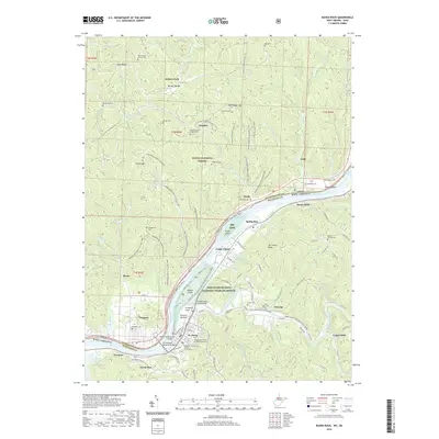
2019 Map of Raven Rock
USGS Topo · Published 2019About this map
The Ohio River carves a deep valley through this borderland, separating St. Marys in West Virginia from the riverfront settlement of Newport, Ohio. A network of protected lands defines the local geography, including the Ohio River Islands National Wildlife Refuge which encompasses Middle Island and Grape Island. On the West Virginia side, the Pleasants County Courthouse stands near the riverbank, linked to the opposite shore by the Hi Carpenter Memorial Bridge.
Find a feature on this map
94 named features on this map. Tap any name to fly to it.
Don’t see what you’re looking for? This feature index may not catch every label — zoom into the map to look around manually.
Map Details
Editions of this 2019 Raven Rock Map
This is the sole edition of this map. No revisions or reprints were ever made.
Other maps of this area

1903 · Macksburg
USGS Topo · 1:62,500

1904 · Marietta
USGS Topo · 1:62,500

1905 · New Matamoras
USGS Topo · 1:62,500

1905 · Macksburg
USGS Topo · 1:62,500

1906 · Saint Marys
USGS Topo · 1:62,500

1924 · St Marys
USGS Topo · 1:62,500

1924 · New Matamoras
USGS Topo · 1:62,500

1924 · Marietta
USGS Topo · 1:62,500

1926 · New Matamoras
USGS Topo · 1:62,500

1927 · Marietta
USGS Topo · 1:62,500