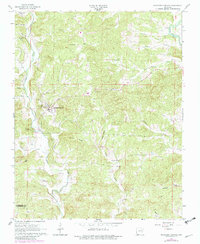
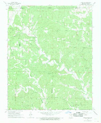
1966 Map of Ravenden Springs
USGS Topo · Published 1982About this map
Ravenden Springs serves as the focal point of this 1960s survey, illustrating a rural landscape shaped by the winding paths of Janes Creek and Hall Creek. The settlement pattern is deeply rooted in local family history and community life, evidenced by a high density of small cemeteries such as Charter Oak Cem, Brown Cem, and Wyatt Cem scattered across the hills. To the northeast, the Eleven Point R cuts through the terrain near Rickman Creek, while significant landmarks like Baker Bluff and Locust Ridge define the local topography. This map documents a period before modern sprawl, showing rural institutions like Bethany Ch and Valley Chapel that anchored these Ozark foothills. For those researching the Randolph Co and Lawrence Co border area, the map provides a precise record of late mid-century farmsteads and rural infrastructure.
Find a feature on this map
35 named features on this map. Tap any name to fly to it.
Don’t see what you’re looking for? This feature index may not catch every label — zoom into the map to look around manually.
Map Details
Editions of this 1966 Ravenden Springs Map
2 editions found
Other maps of this area

1934 · Powhatan
USGS Topo · 1:62,500

1935 · Powhatan
USGS Topo · 1:62,500

1957 · Poplar Bluff
USGS Topo · 1:250,000

1959 · Poplar Bluff
USGS Topo · 1:250,000

1960 · Poplar Bluff
USGS Topo · 1:250,000

1966 · Ravenden Springs
USGS Topo · 1:24,000
1966 · Ravenden Springs SE
USGS Topo · 1:24,000
1966 · Imboden
USGS Topo · 1:24,000
1967 · Warm Springs
USGS Topo · 1:24,000
1968 · Hardy NE
USGS Topo · 1:24,000