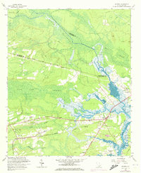
1960 Map of Ravenel
USGS Topo · Published 1973About this map
Horse Savanna and the massive Caw Caw Swamp dominate the low-lying landscape of the South Carolina coastal plain near the boundary of Charleston and Dorchester counties. The map records a transition in the region's transport network, showing the historic corridor of Parkers Ferry Road cutting westward across the swamps toward the Edisto. In the southern half of the sheet, the town of Ravenel serves as a local hub, situated where the Seaboard Coast Line railroad and the Coast Line highway intersect. Small family-named hills like Berry Hill and Miley Hill emerge from the wetlands, often anchored by community centers such as the Miley Hill Sch or St Johns Ch. The eastern edge is defined by the tidal reaches of the Wallace River and Stono River, where the Intracoastal Waterway facilitates maritime passage past Johns Island.
Find a feature on this map
35 named features on this map. Tap any name to fly to it.
Don’t see what you’re looking for? This feature index may not catch every label — zoom into the map to look around manually.
Map Details
Editions of this 1960 Ravenel Map
4 editions found
Other maps of this area

1918 · Cottageville
USGS Topo · 1:62,500

1919 · Ladson
USGS Topo · 1:21,120

1919 · Johns Island
USGS Topo · 1:21,120

1919 · Edisto Island
USGS Topo · 1:62,500

1919 · Wadmelaw Island
USGS Topo · 1:62,500

1919 · Legareville
USGS Topo · 1:21,120

1920 · Ravenels
USGS Topo · 1:62,500

1943 · Cottageville
USGS Topo · 1:62,500

1943 · Legareville
USGS Topo · 1:24,000

1943 · Edisto Island
USGS Topo · 1:62,500