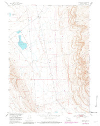
1953 Map of Rawlins NW
USGS Topo · Published 1982About this map
Haystack Mountains dominate the eastern reaches of this Wyoming landscape, rising sharply above a vast low-lying Depression to the west. This mid-century survey, based on 1949 aerial photography and 1980 updates, captures a high-desert environment defined by its drainage basins and industrial infrastructure. The presence of Meadow Station 4 (Abandoned) and multiple Pipe Lines suggests the area's role in supporting regional energy or transportation networks during the post-war era. Water features such as Separation Lake and Dry Lake provide critical reference points for this high-altitude basin, where the peak of VABM Wildhorse 7852 stands as the highest elevation in the southeastern corner, overlooking the complex topography of the Continental Divide region.
Find a feature on this map
8 named features on this map. Tap any name to fly to it.
Don’t see what you’re looking for? This feature index may not catch every label — zoom into the map to look around manually.
Map Details
Editions of this 1953 Rawlins NW Map
3 editions found
Other maps of this area

1953 · Wild Horse Mountain
USGS Topo · 1:24,000

1953 · Sinclair
USGS Topo · 1:24,000

1953 · Riddle Cut
USGS Topo · 1:24,000

1953 · Rawlins
USGS Topo · 1:24,000

1953 · Lone Haystack Mountain
USGS Topo · 1:24,000

1953 · Rawlins NW
USGS Topo · 1:24,000

1954 · Rawlins
USGS Topo · 1:250,000

1955 · Casper
USGS Topo · 1:250,000

1956 · Rawlins Peak
USGS Topo · 1:62,500

1958 · Rawlins
USGS Topo · 1:250,000