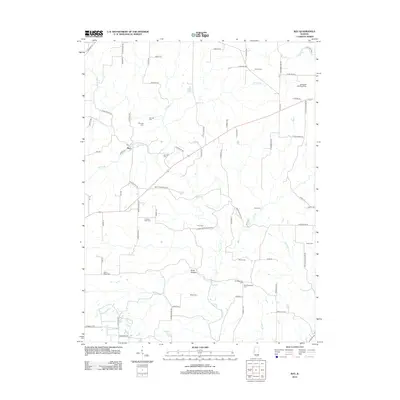
2012 Map of Ray
USGS Topo · Published 2012About this map
The unincorporated community of Ray sits at the heart of this Schuyler County landscape, where the local road network follows the winding course of Sugar Cr and its many tributaries. This area is remarkably dense with family and community burial grounds, serving as a significant resource for genealogical research. Locations like Salem Cem, Christian Neck Cem, and Old Ridgeville Cem are scattered across the terrain, often near former settlement sites or early farmsteads. The geography is defined by a series of hollows and ridges, most notably Scab Hollow and the area near Devil's Backbone Rd. Water features such as Sullivan Lake and Peabody Lake dot the countryside, while the Campbell Landing Strip indicates more modern aviation use among the established agricultural lands and creek bottoms.
Find a feature on this map
78 named features on this map. Tap any name to fly to it.
Don’t see what you’re looking for? This feature index may not catch every label — zoom into the map to look around manually.
Map Details
Editions of this 2012 Ray Map
This is the sole edition of this map. No revisions or reprints were ever made.
Other maps of this area

1912 · Macomb
USGS Topo · 1:62,500

1914 · Macomb
USGS Topo · 1:62,500

1918 · Vermont
USGS Topo · 1:62,500

1921 · Vermont
USGS Topo · 1:62,500

1923 · Rushville
USGS Topo · 1:62,500

1926 · Beardstown
USGS Topo · 1:62,500

1926 · Rushville
USGS Topo · 1:62,500

1944 · Beardstown
USGS Topo · 1:62,500

1947 · Vermont
USGS Topo · 1:24,000
1948 · Vermont
USGS Topo · 1:24,000