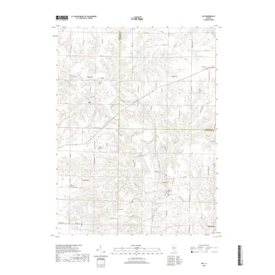
2018 Map of Ray
USGS Topo · Published 2018About this map
The Illinois River valley margin near Browning and Ray is defined by a dense network of creek drainages and upland ridges. This 2018 survey highlights the intricate local topography where Sugar Creek and Dutchmans Cr have carved deep valleys into the landscape. For genealogists and local historians, the sheet is an exceptional record of community burial sites, many of which are tucked away at the ends of rural roads. These include Old Ridgeville Cem and New Ridgeville Cem, alongside family and community landmarks like Christian Neck Cem and Pittenger Cem. The intersection of E State Rte 24 provides a modern transit artery through this deeply etched terrain, connecting the scattered homesteads and farmland that characterize the border between Schuyler and Fulton counties.
Find a feature on this map
102 named features on this map. Tap any name to fly to it.
Don’t see what you’re looking for? This feature index may not catch every label — zoom into the map to look around manually.
Map Details
Editions of this 2018 Ray Map
This is the sole edition of this map. No revisions or reprints were ever made.
Other maps of this area

1912 · Macomb
USGS Topo · 1:62,500

1914 · Macomb
USGS Topo · 1:62,500

1918 · Vermont
USGS Topo · 1:62,500

1921 · Vermont
USGS Topo · 1:62,500

1923 · Rushville
USGS Topo · 1:62,500

1926 · Beardstown
USGS Topo · 1:62,500

1926 · Rushville
USGS Topo · 1:62,500

1944 · Beardstown
USGS Topo · 1:62,500

1947 · Vermont
USGS Topo · 1:24,000
1948 · Vermont
USGS Topo · 1:24,000