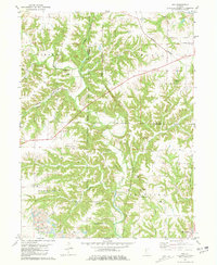
1981 Map of Ray
USGS Topo · Published 1981About this map
The Burlington Northern railroad cuts through the broken timberland of Schuyler and Fulton counties, connecting the small settlements of Ray and Browning. This landscape is defined by the heavy dissection of Sugar Creek and its many tributaries, including Harris Branch and Dutchmans Creek, which have carved deep valleys into the upland prairies. The distribution of family and community landmarks suggests a long-established rural network, evidenced by the high density of cemeteries such as Salem Cem, Pittenger Cem, and Tracy Cem.
Find a feature on this map
38 named features on this map. Tap any name to fly to it.
Don’t see what you’re looking for? This feature index may not catch every label — zoom into the map to look around manually.
Map Details
Editions of this 1981 Ray Map
This is the sole edition of this map. No revisions or reprints were ever made.
Other maps of this area

1912 · Macomb
USGS Topo · 1:62,500

1914 · Macomb
USGS Topo · 1:62,500

1918 · Vermont
USGS Topo · 1:62,500

1921 · Vermont
USGS Topo · 1:62,500

1923 · Rushville
USGS Topo · 1:62,500

1926 · Beardstown
USGS Topo · 1:62,500

1926 · Rushville
USGS Topo · 1:62,500

1944 · Beardstown
USGS Topo · 1:62,500

1947 · Vermont
USGS Topo · 1:24,000
1948 · Vermont
USGS Topo · 1:24,000