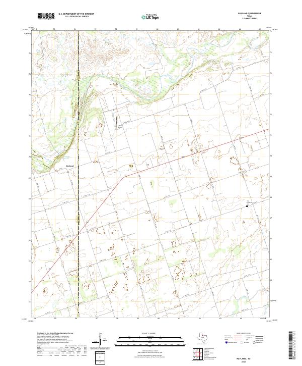
2022 Map of Rayland
USGS Topo · Published 2022About this map
Rayland serves as the primary settlement center in this region of Wilbarger County, situated near the shifting boundary lines shared with Hardeman and Foard counties. The landscape is defined by the braided path of the Pease River as it winds through the northern portion of the quadrangle, creating a complex series of sandbars and wetlands near Antelope Springs. The road network is predominantly a grid of county routes, but historic bypasses like Old River Rd trace the ancient contours of the waterway. To the southeast, the Zion Lutheran Cem provides a focal point for genealogical research, while the presence of Lehman Airport and a series of farm-to-market roads like FM 1207 and FM 98 reflect the modern agricultural and transport infrastructure of this North Texas terrain.
Find a feature on this map
33 named features on this map. Tap any name to fly to it.
Don’t see what you’re looking for? This feature index may not catch every label — zoom into the map to look around manually.
Map Details
Editions of this 2022 Rayland Map
This is the sole edition of this map. No revisions or reprints were ever made.
Other maps of this area

1954 · Wichita Falls
USGS Topo · 1:250,000

1955 · Lawton
USGS Topo · 1:250,000

1958 · Wichita Falls
USGS Topo · 1:250,000

1958 · Vernon
USGS Topo · 1:62,500

1958 · Medicine Mound
USGS Topo · 1:62,500

1966 · Santa Rosa Lake
USGS Topo · 1:24,000

1966 · Thalia
USGS Topo · 1:24,000
1966 · Santa Rosa Lake NW
USGS Topo · 1:24,000

1983 · Warrior Hollow
USGS Topo · 1:24,000

1983 · Tolbert
USGS Topo · 1:24,000