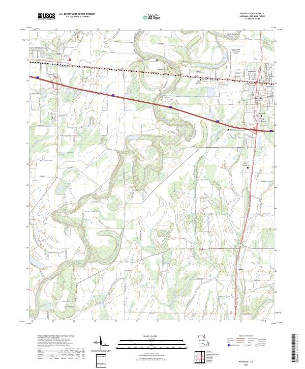
2024 Map of Rayville
USGS Topo · Published 2024About this map
Rayville serves as the focal point of this Richland Parish landscape, where the Boeuf River winds through a complex network of wetlands and agricultural tracts. The map documents the seat of local government at the Richland Parish Courthouse and the nearby John H Hooks Jr Memorial Airport. Beyond the urban center, smaller settlements like Start, Girard, and Dehlco anchor the rural areas. The hydrology is particularly intricate, defined by the winding course of Muddy Bayou and numerous lowland features such as Binion Brake and Lindow Brake. Family and community history is preserved in several burial grounds, including the Masonic Cem, Horn Cem, and the Northeast Louisiana Veterans Cem. The drainage patterns of Ash Slough and Steep Bayou further illustrate the low-lying character of this North Louisiana delta region.
Find a feature on this map
124 named features on this map. Tap any name to fly to it.
Don’t see what you’re looking for? This feature index may not catch every label — zoom into the map to look around manually.
Map Details
Editions of this 2024 Rayville Map
This is the sole edition of this map. No revisions or reprints were ever made.
Other maps of this area

1935 · Collinston
USGS Topo · 1:62,500

1935 · Alto
USGS Topo · 1:62,500

1935 · Baskinton
USGS Topo · 1:62,500

1935 · Hurricane
USGS Topo · 1:62,500

1955 · Jackson
USGS Topo · 1:250,000

1957 · Mangham
USGS Topo · 1:62,500

1957 · Collinston
USGS Topo · 1:62,500

1958 · Baskinton
USGS Topo · 1:62,500

1958 · Hurricane
USGS Topo · 1:62,500

1961 · Jackson
USGS Topo · 1:250,000