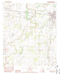
1982 Map of Rayville
USGS Topo · Published 1983About this map
The Boeuf River carves a winding path through this corner of Richland Parish, defining a landscape of low-lying wetlands and brakes. The settlement of Rayville serves as the local hub, established at the intersection of the Illinois Central Gulf railroad and the Pacific line. This 1982 provisional survey illustrates the community's growth around the rail corridor, featuring the Municipal Airport and Blakeman Park.
Find a feature on this map
61 named features on this map. Tap any name to fly to it.
Don’t see what you’re looking for? This feature index may not catch every label — zoom into the map to look around manually.
Map Details
Editions of this 1982 Rayville Map
This is the sole edition of this map. No revisions or reprints were ever made.
Other maps of this area

1935 · Collinston
USGS Topo · 1:62,500

1935 · Alto
USGS Topo · 1:62,500

1935 · Baskinton
USGS Topo · 1:62,500

1935 · Hurricane
USGS Topo · 1:62,500

1955 · Jackson
USGS Topo · 1:250,000

1957 · Mangham
USGS Topo · 1:62,500

1957 · Collinston
USGS Topo · 1:62,500

1958 · Baskinton
USGS Topo · 1:62,500

1958 · Hurricane
USGS Topo · 1:62,500

1961 · Jackson
USGS Topo · 1:250,000