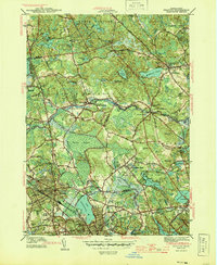
1944 Map of Reading
USGS Topo · Published 1944About this map
Ipswich River winds through this Essex and Middlesex County landscape during the early 1940s, a period marked by wartime utility and established suburban growth. The presence of the Military Police Camp and Camp Curtis Guild, complete with its Rifle Range, underscores the era's military mobilization. Surrounding these installations are the residential cores of North Reading and Reading, where several educational landmarks like Batchelder Sch and Highland Sch serve the growing community.
Find a feature on this map
94 named features on this map. Tap any name to fly to it.
Don’t see what you’re looking for? This feature index may not catch every label — zoom into the map to look around manually.
Map Details
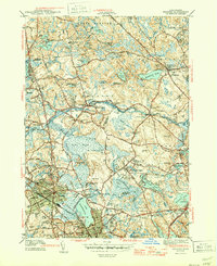
Editions of this 1944 Reading Map
2 editions found
Other maps of this area

1886 · Lawrence
USGS Topo · 1:62,500

1888 · Lawrence
USGS Topo · 1:62,500

1888 · Salem
USGS Topo · 1:62,500

1892 · Boston Bay
USGS Topo · 1:62,500

1893 · Salem
USGS Topo · 1:62,500

1893 · Boston
USGS Topo · 1:62,500

1893 · Lawrence
USGS Topo · 1:62,500

1903 · Boston
USGS Topo · 1:62,500

1903 · Boston Bay
USGS Topo · 1:62,500

1917 · Salem
USGS Topo · 1:62,500