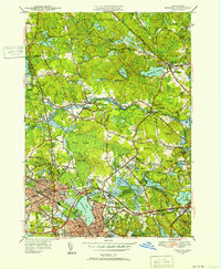
1951 Map of Reading
USGS Topo · Published 1952About this map
Lake Quannapowitt serves as a prominent landmark at the southern edge of this suburban landscape, anchoring the developed centers of Wakefield and Reading. Revised in the early 1950s, the map illustrates a region in transition, where established town centers and industrial rail corridors of the Boston and Maine Railroad coexist with extensive wetlands like Cedar Swamp. The presence of several country clubs, including the Sagamore Springs Golf Club and Colonial Golf and Country Club, alongside the Military Police Camp and Camp Curtis Guild, reflects a diverse mid-century land use pattern ranging from recreation to national defense.
Find a feature on this map
74 named features on this map. Tap any name to fly to it.
Don’t see what you’re looking for? This feature index may not catch every label — zoom into the map to look around manually.
Map Details
Editions of this 1951 Reading Map
3 editions found
Other maps of this area

1886 · Lawrence
USGS Topo · 1:62,500

1888 · Lawrence
USGS Topo · 1:62,500

1888 · Salem
USGS Topo · 1:62,500

1892 · Boston Bay
USGS Topo · 1:62,500

1893 · Salem
USGS Topo · 1:62,500

1893 · Boston
USGS Topo · 1:62,500

1893 · Lawrence
USGS Topo · 1:62,500

1903 · Boston
USGS Topo · 1:62,500

1903 · Boston Bay
USGS Topo · 1:62,500

1917 · Salem
USGS Topo · 1:62,500