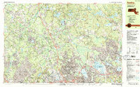
1987 Map of Reading
USGS Topo · Published 1987About this map
The town of Reading and its surrounding Middlesex County suburbs are documented here during a period of significant late-twentieth-century residential and infrastructure growth. Central to the map is the large recreational expanse of Lake Quannapowitt in Wakefield, which serves as a landmark alongside the extensive Camp Curtis Guild National Guard Reservation. The landscape is a mix of dense suburban tracts and large institutional or preserved spaces, such as the State Hospital in Tewksbury and the southern reaches of the Harold Parker State Forest.
Find a feature on this map
119 named features on this map. Tap any name to fly to it.
Don’t see what you’re looking for? This feature index may not catch every label — zoom into the map to look around manually.
Map Details
Editions of this 1987 Reading Map
2 editions found
Other maps of this area

1886 · Lawrence
USGS Topo · 1:62,500

1886 · Lowell
USGS Topo · 1:62,500

1886 · Framingham
USGS Topo · 1:62,500

1888 · Lawrence
USGS Topo · 1:62,500

1888 · Salem
USGS Topo · 1:62,500

1889 · Framingham
USGS Topo · 1:62,500

1892 · Boston Bay
USGS Topo · 1:62,500

1893 · Lowell
USGS Topo · 1:62,500

1893 · Salem
USGS Topo · 1:62,500

1893 · Boston
USGS Topo · 1:62,500