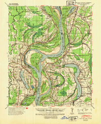
1939 Map of Readland
USGS Topo · Published 1954About this map
The Mississippi River defines this landscape on the eve of World War II, where the shifting waters have carved a complex geography of cut-offs and towheads along the Arkansas Mississippi border. The map illustrates the significant impact of river engineering, noting the American Cut-Off 1858 and the older Grand Lake Cut-Off 1796-1817. These changes isolated former river bends, creating massive oxbow lakes like Grand Lake and Lake Washington, which became the focal points for local settlements.
Find a feature on this map
72 named features on this map. Tap any name to fly to it.
Don’t see what you’re looking for? This feature index may not catch every label — zoom into the map to look around manually.
Map Details
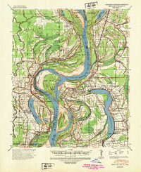
Editions of this 1939 Readland Map
3 editions found
Other maps of this area

1909 · Wilsons Point
USGS Topo · 1:24,000

1909 · Millikin
USGS Topo · 1:24,000

1909 · Ashton Bridge
USGS Topo · 1:24,000

1912 · Ashton Bridge
USGS Topo · 1:31,680

1913 · Wilson Point
USGS Topo · 1:31,680

1935 · Oak Grove
USGS Topo · 1:62,500

1936 · Eudora
USGS Topo · 1:62,500

1936 · Lake Village
USGS Topo · 1:62,500

1939 · Lorenzen
USGS Topo · 1:62,500

1939 · Readland
USGS Topo · 1:62,500