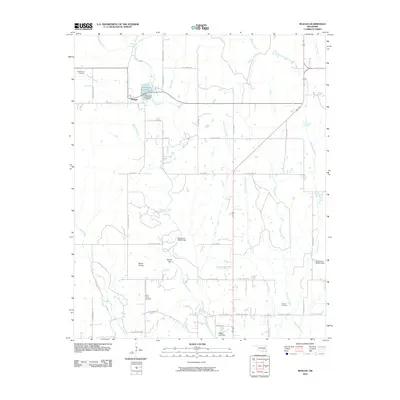
2010 Map of Reagan
USGS Topo · Published 2010About this map
The Tishomingo National Fish Hatchery is a prominent landscape feature just south of the settlement at Reagan, where the waters of Pennington Creek and the Reagan Branch provide the necessary flow for Oklahoma conservation efforts. This survey captures the rural character of Johnston County, defined by a network of local roads such as Pace Rd and Keel Creek Rd that connect isolated homesteads and historical burial grounds. Genealogists and local historians can locate three distinct cemeteries on this sheet: Greenwood Cemetery, Bullet Prairie Cemetery, and Duncan Cemetery.
Find a feature on this map
51 named features on this map. Tap any name to fly to it.
Don’t see what you’re looking for? This feature index may not catch every label — zoom into the map to look around manually.
Map Details
Editions of this 2010 Reagan Map
This is the sole edition of this map. No revisions or reprints were ever made.
Other maps of this area

1901 · Tishomingo
USGS Topo · 1:125,000

1957 · Ardmore
USGS Topo · 1:250,000

1963 · Ardmore
USGS Topo · 1:250,000

1963 · Mill Creek
USGS Topo · 1:24,000

1963 · Troy
USGS Topo · 1:24,000

1963 · Ravia
USGS Topo · 1:24,000

1967 · Connerville SE
USGS Topo · 1:24,000

1967 · Connerville
USGS Topo · 1:24,000
1967 · Connerville NE
USGS Topo · 1:24,000

1967 · Tishomingo
USGS Topo · 1:24,000