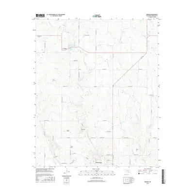
2016 Map of Reagan
USGS Topo · Published 2016About this map
Tishomingo and the small settlement of Reagan anchor this 2016 survey of Johnston County, where the landscape is defined by the drainage networks of Pennington Creek and Big Sandy Cr. Local history and genealogy are well-represented by several family or community landmarks, including Greenwood Cem, Anvil Rock Cem, and Bullet Prairie Cem. The southern portion of the sheet near Tishomingo transitions into more developed infrastructure, featuring Webb Lake and the Golf Course Rd corridor. Significant natural terrain features such as Devils Den, Bullet Prairie, and Slippery Falls provide specific points of interest for researchers studying the geography of the Blue River watershed. A dense network of rural roads, such as N John Ross Rd and Keel Creek Rd, reveals the residential and agricultural pattern of the region in the early 21st century.
Find a feature on this map
61 named features on this map. Tap any name to fly to it.
Don’t see what you’re looking for? This feature index may not catch every label — zoom into the map to look around manually.
Map Details
Editions of this 2016 Reagan Map
This is the sole edition of this map. No revisions or reprints were ever made.
Other maps of this area

1901 · Tishomingo
USGS Topo · 1:125,000

1957 · Ardmore
USGS Topo · 1:250,000

1963 · Ardmore
USGS Topo · 1:250,000

1963 · Mill Creek
USGS Topo · 1:24,000

1963 · Troy
USGS Topo · 1:24,000

1963 · Ravia
USGS Topo · 1:24,000

1967 · Connerville SE
USGS Topo · 1:24,000

1967 · Connerville
USGS Topo · 1:24,000
1967 · Connerville NE
USGS Topo · 1:24,000

1967 · Tishomingo
USGS Topo · 1:24,000