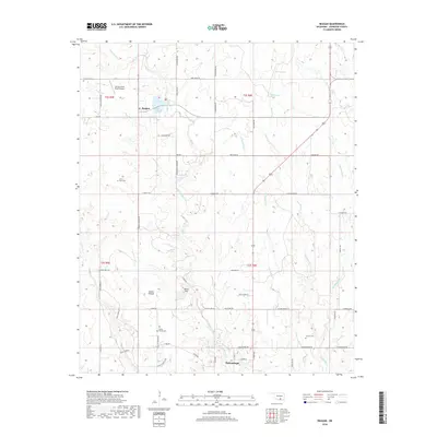
2018 Map of Reagan
USGS Topo · Published 2018About this map
Tishomingo and the smaller settlement of Reagan anchor this Johnston County landscape, where the waters of Pennington Cr and Little Sandy Cr carve through the Oklahoma terrain. The map documents a rural transition where traditional land names like Bullet Prairie meet modern infrastructure such as the Spring Creek Ranch Airport. Local history is preserved through the locations of several burial grounds, including Bullet Prairie Cem and Duncan Cem, which serve as quiet markers of the area's early settlement families.
Find a feature on this map
67 named features on this map. Tap any name to fly to it.
Don’t see what you’re looking for? This feature index may not catch every label — zoom into the map to look around manually.
Map Details
Editions of this 2018 Reagan Map
This is the sole edition of this map. No revisions or reprints were ever made.
Other maps of this area

1901 · Tishomingo
USGS Topo · 1:125,000

1957 · Ardmore
USGS Topo · 1:250,000

1963 · Ardmore
USGS Topo · 1:250,000

1963 · Mill Creek
USGS Topo · 1:24,000

1963 · Troy
USGS Topo · 1:24,000

1963 · Ravia
USGS Topo · 1:24,000

1967 · Connerville SE
USGS Topo · 1:24,000

1967 · Connerville
USGS Topo · 1:24,000
1967 · Connerville NE
USGS Topo · 1:24,000

1967 · Tishomingo
USGS Topo · 1:24,000