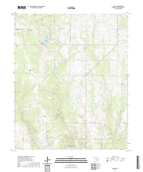
2022 Map of Reagan
USGS Topo · Published 2022About this map
Pennington Creek and its many tributaries, including Buzzard Cr and Little Sandy Cr, define the drainage patterns of this Johnston County landscape. The settlement of Reagan sits at the intersection of several local routes, while the northern edge of Tishomingo appears to the south. This area is characterized by a mix of creek-fed bottoms and distinct geological formations like Anvil Rock and the Devils Den area. Local history is anchored by several family and community burial grounds, such as Greenwood Cem and Bullet Prairie Cem, which are often located near long-established prairie land. The presence of the Spring Creek Ranch Airport near Reagan Br highlights how modern transit infrastructure overlays traditional ranching and farming tracts. The network of section-line roads, including S Sawmill Rd and Log Cabin Rd, continues to dictate the movement and development across Bullet Prairie.
Find a feature on this map
68 named features on this map. Tap any name to fly to it.
Don’t see what you’re looking for? This feature index may not catch every label — zoom into the map to look around manually.
Map Details
Editions of this 2022 Reagan Map
This is the sole edition of this map. No revisions or reprints were ever made.
Other maps of this area

1901 · Tishomingo
USGS Topo · 1:125,000

1957 · Ardmore
USGS Topo · 1:250,000

1963 · Ardmore
USGS Topo · 1:250,000

1963 · Mill Creek
USGS Topo · 1:24,000

1963 · Troy
USGS Topo · 1:24,000

1963 · Ravia
USGS Topo · 1:24,000

1967 · Connerville SE
USGS Topo · 1:24,000

1967 · Connerville
USGS Topo · 1:24,000
1967 · Connerville NE
USGS Topo · 1:24,000

1967 · Tishomingo
USGS Topo · 1:24,000