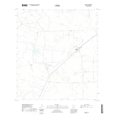
2019 Map of Realitos
USGS Topo · Published 2019About this map
Realitos Colonia serves as the central hub of this Duval County landscape, where the intersection of local infrastructure and industrial operations defines the settlement pattern. The local economy and transportation network are anchored by the O S Wyatt Airport and the specialized Wright-Brothers Materials Plant Reservoir, which reflects the area's industrial water needs. A web of county roads, including Co RD 272 and Co RD 262, connects the scattered ranching and industrial sites across a terrain marked by ephemeral water features.
Find a feature on this map
23 named features on this map. Tap any name to fly to it.
Don’t see what you’re looking for? This feature index may not catch every label — zoom into the map to look around manually.
Map Details
Editions of this 2019 Realitos Map
This is the sole edition of this map. No revisions or reprints were ever made.
Other maps of this area

1921 · Falfurrias
USGS Topo · 1:125,000

1956 · Benavides
USGS Topo · 1:62,500

1956 · Laredo
USGS Topo · 1:250,000

1967 · Hebbronville SE
USGS Topo · 1:24,000

1967 · Parrilla Creek SE
USGS Topo · 1:24,000

1967 · Realitos
USGS Topo · 1:24,000

1967 · Hebbronville NW
USGS Topo · 1:24,000

1967 · Hebbronville
USGS Topo · 1:24,000

1968 · Parrilla Creek SW
USGS Topo · 1:24,000

1968 · Benavides
USGS Topo · 1:24,000