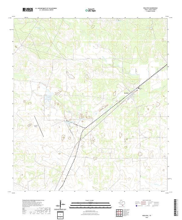
2022 Map of Realitos
USGS Topo · Published 2022About this map
Realitos serves as the central hub of this South Texas landscape, where the local street grid including Railroad Blvd, Cornwall St, and Adkins ST meets the regional path of State Highway 359. The surrounding terrain is defined by the ephemeral drainage of Concepcion Cr and Macho Cr, punctuated by numerous ranching landmarks such as Guaturche Tank and Bonita Tank.
Find a feature on this map
24 named features on this map. Tap any name to fly to it.
Don’t see what you’re looking for? This feature index may not catch every label — zoom into the map to look around manually.
Map Details
Editions of this 2022 Realitos Map
This is the sole edition of this map. No revisions or reprints were ever made.
Other maps of this area

1921 · Falfurrias
USGS Topo · 1:125,000

1956 · Benavides
USGS Topo · 1:62,500

1956 · Laredo
USGS Topo · 1:250,000

1967 · Hebbronville SE
USGS Topo · 1:24,000

1967 · Parrilla Creek SE
USGS Topo · 1:24,000

1967 · Realitos
USGS Topo · 1:24,000

1967 · Hebbronville NW
USGS Topo · 1:24,000

1967 · Hebbronville
USGS Topo · 1:24,000

1968 · Parrilla Creek SW
USGS Topo · 1:24,000

1968 · Benavides
USGS Topo · 1:24,000