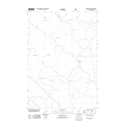
2011 Map of Reanus Cone
USGS Topo · Published 2011About this map
Reanus Cone dominates this high plains landscape in Powder River County, where water management is the defining human footprint. Numerous catchments and reservoirs, including Howes Reservoir, Seymour Reservoir, and Stewart Reservoir, dot the drainages of South Fork Taylor Creek and Indian Creek. These features indicate the vital role of livestock ranching and water conservation in this arid region of Montana. The transport network is sparse, centered on the Reanus Cone Rd and the Yonkee Cutoff, which provide access through the varying elevations of Thompson Draw. Researchers can also locate specific groundwater sources such as the 08S46E04DDD B01 Spring, reflecting the detailed hydrological data typical of 21st-century topographic surveys.
Find a feature on this map
19 named features on this map. Tap any name to fly to it.
Don’t see what you’re looking for? This feature index may not catch every label — zoom into the map to look around manually.
Map Details
Editions of this 2011 Reanus Cone Map
This is the sole edition of this map. No revisions or reprints were ever made.
Other maps of this area

1954 · Hardin
USGS Topo · 1:250,000

1954 · Ekalaka
USGS Topo · 1:250,000

1956 · Ekalaka
USGS Topo · 1:250,000

1957 · Hardin
USGS Topo · 1:250,000

1958 · Ekalaka
USGS Topo · 1:250,000

1958 · Hardin
USGS Topo · 1:250,000

1965 · Ekalaka
USGS Topo · 1:250,000

1966 · Goodspeed Butte
USGS Topo · 1:24,000

1966 · Phillips Butte
USGS Topo · 1:24,000

1966 · Fort Howes
USGS Topo · 1:24,000