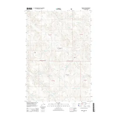
2014 Map of Reanus Cone
USGS Topo · Published 2014About this map
Custer National Forest lands dominate this corner of Powder River County, Montana, where the terrain is defined by a dense network of seasonal creek beds and numerous man-made water catchments. The eponymous Reanus Cone stands as a primary landmark above the drainage of Reanus Creek and its associated Reanus Reservoir. This cattle-country landscape is heavily modified for water management, featuring scattered upland reservoirs like Howes Reservoir, Stewart Reservoir, and Indian Reservoir, alongside named springs used to support ranching in an arid environment. The road network is sparse, centered on the gravel routes of Highline Rd and Sayle Rd, which navigate the draws between the timbered forest sections. The detailed mapping of small waterways, including Little Bradshaw Creek and S Fork Taylor Creek, illustrates the complex erosion patterns and drainage systems essential for navigating and managing this remote high-plains topography.
Find a feature on this map
35 named features on this map. Tap any name to fly to it.
Don’t see what you’re looking for? This feature index may not catch every label — zoom into the map to look around manually.
Map Details
Editions of this 2014 Reanus Cone Map
This is the sole edition of this map. No revisions or reprints were ever made.
Other maps of this area

1954 · Hardin
USGS Topo · 1:250,000

1954 · Ekalaka
USGS Topo · 1:250,000

1956 · Ekalaka
USGS Topo · 1:250,000

1957 · Hardin
USGS Topo · 1:250,000

1958 · Ekalaka
USGS Topo · 1:250,000

1958 · Hardin
USGS Topo · 1:250,000

1965 · Ekalaka
USGS Topo · 1:250,000

1966 · Goodspeed Butte
USGS Topo · 1:24,000

1966 · Phillips Butte
USGS Topo · 1:24,000

1966 · Fort Howes
USGS Topo · 1:24,000