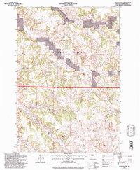
1995 Map of Reanus Cone
USGS Topo · Published 1998About this map
Custer National Forest lands dominate this landscape in southeastern Montana, where the terrain is marked by a complex network of draws and intermittent drainages. The topography is anchored by the prominent Reanus Cone, with the surrounding area utilized for water management as evidenced by numerous small catchments like Howes Reservoir, Seymour Reservoir, and Stewart Reservoir. These water sources, alongside Indian Spring, supported the ranching and resource needs of the region during the late twentieth century.
Find a feature on this map
19 named features on this map. Tap any name to fly to it.
Don’t see what you’re looking for? This feature index may not catch every label — zoom into the map to look around manually.
Map Details
Editions of this 1995 Reanus Cone Map
This is the sole edition of this map. No revisions or reprints were ever made.
Other maps of this area

1954 · Hardin
USGS Topo · 1:250,000

1954 · Ekalaka
USGS Topo · 1:250,000

1956 · Ekalaka
USGS Topo · 1:250,000

1957 · Hardin
USGS Topo · 1:250,000

1958 · Ekalaka
USGS Topo · 1:250,000

1958 · Hardin
USGS Topo · 1:250,000

1965 · Ekalaka
USGS Topo · 1:250,000

1966 · Goodspeed Butte
USGS Topo · 1:24,000

1966 · Phillips Butte
USGS Topo · 1:24,000

1966 · Fort Howes
USGS Topo · 1:24,000