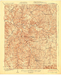
1931 Map of Red Boiling Springs
USGS Topo · Published 1931About this map
Red Boiling Springs serves as a focal point in this 1931 survey of the borderlands between North-Central Tennessee and Southern Kentucky. The landscape is defined by the winding course of the Barren River and a dense network of upland hollows and ridges. This era is characterized by an exceptional density of rural community markers, with dozens of one-room schoolhouses like Snooze Sch and Rocky Point Sch scattered across the hills alongside churches such as Salem Ch and Whiteoak Ch.
Find a feature on this map
87 named features on this map. Tap any name to fly to it.
Don’t see what you’re looking for? This feature index may not catch every label — zoom into the map to look around manually.
Map Details
Editions of this 1931 Red Boiling Springs Map
3 editions found
Other maps of this area

1925 · Gainesboro
USGS Topo · 1:62,500

1926 · Scottsville
USGS Topo · 1:62,500

1929 · Gainesboro
USGS Topo · 1:62,500

1929 · Tompkinsville
USGS Topo · 1:62,500

1931 · Lafayette
USGS Topo · 1:62,500

1931 · Red Boiling Springs
USGS Topo · 1:62,500

1932 · Carthage
USGS Topo · 1:62,500

1953 · Tracy
USGS Topo · 1:24,000

1953 · Sulphur Lick
USGS Topo · 1:24,000

1953 · Freedom
USGS Topo · 1:24,000