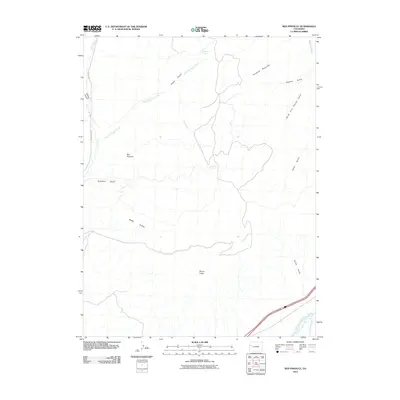
2010 Map of Red Pinnacle
USGS Topo · Published 2010About this map
The Roan Cliffs dominate this high-desert landscape of western Colorado, forming a massive natural boundary that separates the upland plateaus from the river valley below. This 2010 survey focuses on a complex network of drainage systems, including Conn Creek and its many tributaries, which have carved deep features like Baker Gulch and Starkey Gulch into the terrain. Prominent landmarks such as Red Pinnacle and Haystack Mountain rise above the ridgelines, while Pritchard Spring and Hayward Spring offer isolated water sources in this arid environment.
Find a feature on this map
22 named features on this map. Tap any name to fly to it.
Don’t see what you’re looking for? This feature index may not catch every label — zoom into the map to look around manually.
Map Details
Editions of this 2010 Red Pinnacle Map
This is the sole edition of this map. No revisions or reprints were ever made.
Other maps of this area

1925 · Parachute Creek
USGS Topo · 1:62,500

1927 · Parachute Creek
USGS Topo · 1:62,500

1929 · Grand Valley
USGS Topo · 1:62,500

1929 · Highmore
USGS Topo · 1:62,500

1929 · Roan Creek
USGS Topo · 1:62,500

1956 · Grand Junction
USGS Topo · 1:250,000

1959 · Grand Junction
USGS Topo · 1:250,000

1960 · Grand Junction
USGS Topo · 1:250,000

1962 · Grand Junction
USGS Topo · 1:250,000
1962 · Grand Valley
USGS Topo · 1:24,000