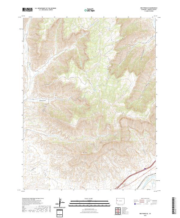
2022 Map of Red Pinnacle
USGS Topo · Published 2022About this map
Mt Logan and the Red Pinnacle define this portion of the Western Slope, where the drainage systems of Conn Cr and Logan Wash carve through the high plateau. The landscape is marked by steep elevation changes, ranging from the prominent peaks down to the Colorado River corridor in the southeast corner. Human intervention in this arid environment is evident in the Bluestone Valley Ditch, an irrigation feature skirting the river valley floor. Remote water sources like Hayward Spring and Prichard Spring are noted among the numerous ravines such as Bowdish Gulch and Starkey Gulch. This survey captures the region's character as a land of complex topography and vital water management, where named landmarks served as essential navigational points for those traversing the Colorado backcountry.
Find a feature on this map
25 named features on this map. Tap any name to fly to it.
Don’t see what you’re looking for? This feature index may not catch every label — zoom into the map to look around manually.
Map Details
Editions of this 2022 Red Pinnacle Map
This is the sole edition of this map. No revisions or reprints were ever made.
Other maps of this area

1925 · Parachute Creek
USGS Topo · 1:62,500

1927 · Parachute Creek
USGS Topo · 1:62,500

1929 · Grand Valley
USGS Topo · 1:62,500

1929 · Highmore
USGS Topo · 1:62,500

1929 · Roan Creek
USGS Topo · 1:62,500

1956 · Grand Junction
USGS Topo · 1:250,000

1959 · Grand Junction
USGS Topo · 1:250,000

1960 · Grand Junction
USGS Topo · 1:250,000

1962 · Grand Junction
USGS Topo · 1:250,000
1962 · Grand Valley
USGS Topo · 1:24,000