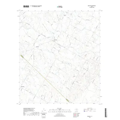
2019 Map of Red Rock
USGS Topo · Published 2019About this map
Red Rock and Rockne anchor this portion of the Texas landscape, situated along the diagonal boundary between Bastrop and Caldwell counties. The area is characterized by a high density of rural burial grounds, including the Old Red Rock Cem, Red Rock Cem, and the Meredith Cem to the north, providing significant primary data for genealogists tracing early families in the region. The drainage network is particularly intricate here, with Upper Cedar Hollow and Lower Cedar Hollow feeding into a system of creeks such as Walnut Cr, Elm Cr, and Upper Elm Cr. Small rural settlements like Bateman and Taylorsville are connected by a web of local roads and farm-to-market routes, including FM 20 and FM 812 Farm-to-Market Rd, which cut across the varied terrain of Flag Hill and the basin surrounding Huber Lake.
Find a feature on this map
88 named features on this map. Tap any name to fly to it.
Don’t see what you’re looking for? This feature index may not catch every label — zoom into the map to look around manually.
Map Details
Editions of this 2019 Red Rock Map
This is the sole edition of this map. No revisions or reprints were ever made.
Other maps of this area

1885 · Bastrop
USGS Topo · 1:125,000

1893 · Bastrop
USGS Topo · 1:125,000

1896 · Austin
USGS Topo · 1:125,000

1897 · Austin
USGS Topo · 1:125,000

1901 · Flatonia
USGS Topo · 1:125,000

1904 · Bastrop
USGS Topo · 1:125,000

1910 · Austin
USGS Topo · 1:125,000

1911 · San Marcos
USGS Topo · 1:125,000

1919 · San Marcos
USGS Topo · 1:125,000

1925 · San Marcos 1-d
USGS Topo · 1:48,000