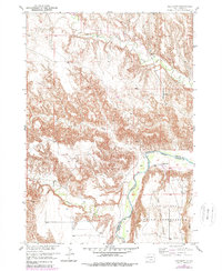
1951 Map of Red Shirt
USGS Topo · Published 1979About this map
The Red Shirt settlement occupies a prominent position on the eastern bank of the Cheyenne River within the Pine Ridge Indian Reservation. This 1951 survey, updated in the late 1970s, documents the complex drainage system where Battle Creek, French Creek, and Red Shirt Creek converge toward the river valley. The landscape is dominated by the sharply defined Pine Ridge Table to the southeast, a high plateau rising above the surrounding breaks. A notable Reservation Boundary bisects the area, separating the tribal lands of the reservation from the western territory. The presence of a river Ford near the settlement underscores the historical reliance on seasonal crossings in an era when permanent bridges were scarce in this part of the Missouri River Basin. The map provides a detailed look at the transition from the upland tablelands to the deeply eroded creek beds that define the local topography.
Find a feature on this map
11 named features on this map. Tap any name to fly to it.
Don’t see what you’re looking for? This feature index may not catch every label — zoom into the map to look around manually.
Map Details
Editions of this 1951 Red Shirt Map
3 editions found
Other maps of this area

1894 · Hermosa
USGS Topo · 1:125,000

1901 · Hermosa
USGS Topo · 1:125,000

1951 · Fairburn SE
USGS Topo · 1:24,000

1951 · Red Shirt
USGS Topo · 1:24,000

1951 · Red Shirt NE
USGS Topo · 1:24,000

1951 · Red Shirt SW
USGS Topo · 1:24,000

1951 · Cuny Table West
USGS Topo · 1:24,000

1953 · Hermosa SE
USGS Topo · 1:24,000

1953 · Folsom
USGS Topo · 1:24,000

1953 · Caputa SW
USGS Topo · 1:24,000