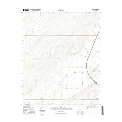
2016 Map of Redden
USGS Topo · Published 2016About this map
Redden stands at the southwestern corner of this landscape, where the flatlands of McGee Valley meet the rising elevations of the Ouachita Mountains. The terrain is defined by a dense network of drainages including McGee Creek, Tommy Bond Br, and Baker Br, which carve out notable landforms like Sharp Hollow and Happy Hollow. High points such as Hewitt Mtn and Jackfork Mtn overlook the southern reaches, while the modern corridor of the Turnpike cuts a sharp line through the eastern hills. Local history is anchored by several family and community burial sites, including Redden Cem, Baker Cem, and Hewitt Cem, providing critical landmarks for genealogical research. The presence of the Cochran Ranch Airport north of the county line suggests the continued importance of ranching and private aviation in this sparsely populated region of Atoka County.
Find a feature on this map
45 named features on this map. Tap any name to fly to it.
Don’t see what you’re looking for? This feature index may not catch every label — zoom into the map to look around manually.
Map Details
Editions of this 2016 Redden Map
This is the sole edition of this map. No revisions or reprints were ever made.
Other maps of this area

1898 · McAlester
USGS Topo · 1:125,000

1901 · Antlers
USGS Topo · 1:125,000

1909 · Mc Alester
USGS Topo · 1:125,000

1912 · Antlers
USGS Topo · 1:125,000

1925 · Antlers
USGS Topo · 1:125,000

1950 · Mcalester
USGS Topo · 1:250,000

1957 · Lane NW
USGS Topo · 1:24,000

1957 · Jumbo
USGS Topo · 1:24,000

1957 · Lane NE
USGS Topo · 1:24,000

1957 · Limestone Gap
USGS Topo · 1:24,000