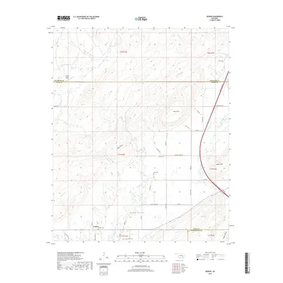
2019 Map of Redden
USGS Topo · Published 2019About this map
McGee Valley defines the landscape of this southern Oklahoma quadrangle, where the waters of McGee Creek and Little Caney Cr converge. The settlement of Redden sits at the junction of local roads in the southwest, serving as a focal point for researchers interested in the rural development of Atoka County. The terrain is marked by the significant rise of Jackfork Mtn in the east and Hewitt Mtn near the center, creating a complex series of ridges and hollows such as Sharp Hollow and Spring Hollow. This 2019 survey documents the modern infrastructure of the region, anchored by the Indian Nation Tpke cutting across the eastern hills. For genealogists, the map identifies several local burial grounds including Redden Cem, Baker Cem, and Hewitt Cem, providing exact locations for family history research in this sparsely populated cattle and timber country.
Find a feature on this map
53 named features on this map. Tap any name to fly to it.
Don’t see what you’re looking for? This feature index may not catch every label — zoom into the map to look around manually.
Map Details
Editions of this 2019 Redden Map
This is the sole edition of this map. No revisions or reprints were ever made.
Other maps of this area

1898 · McAlester
USGS Topo · 1:125,000

1901 · Antlers
USGS Topo · 1:125,000

1909 · Mc Alester
USGS Topo · 1:125,000

1912 · Antlers
USGS Topo · 1:125,000

1925 · Antlers
USGS Topo · 1:125,000

1950 · Mcalester
USGS Topo · 1:250,000

1957 · Lane NW
USGS Topo · 1:24,000

1957 · Jumbo
USGS Topo · 1:24,000

1957 · Lane NE
USGS Topo · 1:24,000

1957 · Limestone Gap
USGS Topo · 1:24,000