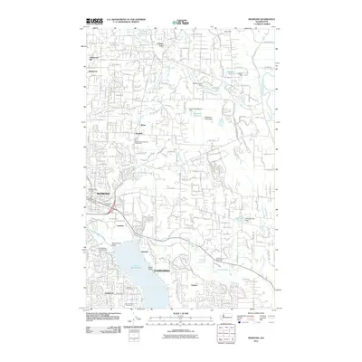
2011 Map of Redmond
USGS Topo · Published 2011About this map
The Sammamish and Redmond areas are defined by a complex network of waterways and suburban expansion at the start of the 2010s. The northern reaches are characterized by the residential neighborhoods of Hollywood Hill and Avondale, while the southern portion transitions into the developed shoreline of Lake Sammamish. The Sammamish Valley provides a distinct geographical break between the plateaus, with the Sammamish River and Bear Creek serving as primary drainage corridors.
Find a feature on this map
43 named features on this map. Tap any name to fly to it.
Don’t see what you’re looking for? This feature index may not catch every label — zoom into the map to look around manually.
Map Details
Editions of this 2011 Redmond Map
This is the sole edition of this map. No revisions or reprints were ever made.
Other maps of this area

1895 · Snohomish
USGS Topo · 1:125,000

1897 · Seattle
USGS Topo · 1:125,000

1921 · Sultan
USGS Topo · 1:125,000

1923 · Sultan
USGS Topo · 1:125,000

1944 · Everett
USGS Topo · 1:62,500

1950 · Redmond
USGS Topo · 1:24,000
1950 · Mercer Island
USGS Topo · 1:24,000

1950 · Issaquah
USGS Topo · 1:24,000

1950 · Kirkland
USGS Topo · 1:24,000

1953 · Monroe
USGS Topo · 1:24,000