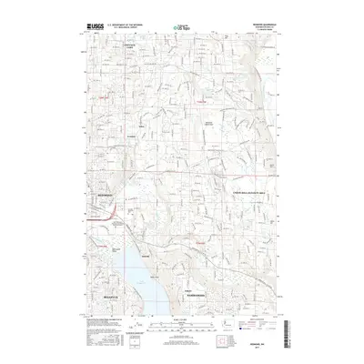
2017 Map of Redmond
USGS Topo · Published 2017About this map
Lake Washington Institute of Technology Redmond Campus and the Eastside Memorial Park stand as modern landmarks in a landscape defined by its rapid suburban development and varied water features. The northern reaches are anchored by Cottage Lake, while the western edge transitions into the industrial and commercial core of Redmond. The map reveals a dense network of suburban streets and planned communities like Sahalee and Adelaide, juxtaposed against the protected expanse of the Redmond Watershed.
Find a feature on this map
146 named features on this map. Tap any name to fly to it.
Don’t see what you’re looking for? This feature index may not catch every label — zoom into the map to look around manually.
Map Details
Editions of this 2017 Redmond Map
This is the sole edition of this map. No revisions or reprints were ever made.
Other maps of this area

1895 · Snohomish
USGS Topo · 1:125,000

1897 · Seattle
USGS Topo · 1:125,000

1921 · Sultan
USGS Topo · 1:125,000

1923 · Sultan
USGS Topo · 1:125,000

1944 · Everett
USGS Topo · 1:62,500

1950 · Redmond
USGS Topo · 1:24,000
1950 · Mercer Island
USGS Topo · 1:24,000

1950 · Issaquah
USGS Topo · 1:24,000

1950 · Kirkland
USGS Topo · 1:24,000

1953 · Monroe
USGS Topo · 1:24,000